Architecture & Hardware — How ROOT Is Built
What is ROOT? ROOT is the asset behind the product: a calibrated reference model of the Peruvian Amazon, a living digital twin built once and reused many times. Every signed evidence artifact the Terminal delivers is produced from it. ROOT is the infrastructure; the signed artifact is the product. This page is how that infrastructure is built.
The method — measure precisely, extend everywhere
CeibaQ builds one calibrated model of the Peruvian Amazon, ROOT, and produces every evidence artifact from it. The method is to measure precisely in a few places and extend rigorously everywhere else, with a quantified uncertainty on every value. Points (nodes, field plots, environmental DNA) calibrate lines (drone-LiDAR strips), which calibrate polygons (satellite coverage) — the same sparse-reference-plus-fusion approach behind NASA's GEDI mission.
The sensor network is densified by ecosystem stratum, not by area — a proprietary method developed in-house, and the reason cost per hectare falls as coverage grows.
The measurements are made on land we control
CeibaQ operates its own conservation concessions, growing toward one million hectares across the Amazon and into other basin countries, deliberately chosen to cover every ecosystem subtype, so the reference model is calibrated against the full range of the forest rather than one corner of it.
On that land we run current, best-in-class instruments, integrated into a single network, to measure on the order of 1,500 ecosystem parameters at the reference points and extend them across the forest. This is the stack the round begins to deploy.
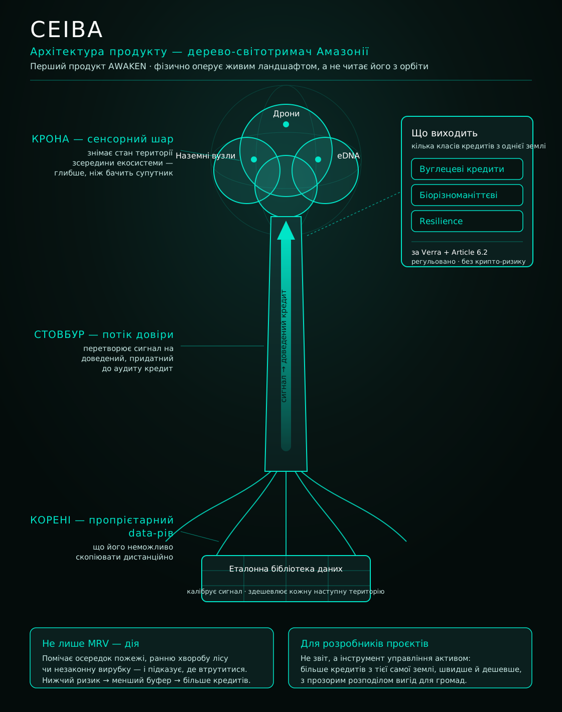
What we measure and fuse
- Direct field measurement. Our own network of sensor nodes across the forest, calibrated on site season by season; field teams sample and check on the ground; flux towers measure carbon, greenhouse-gas and water exchange directly.
- Drone-LiDAR. Drones scan the forest's three-dimensional structure — the bridge from sparse ground points to wall-to-wall coverage — each pass calibrated against the ground nodes.
- Environmental DNA and bioacoustics. Species presence and disturbance read from genetic traces in soil and water and from the recorded sounds of the forest.
- Satellite, including radar. Optical and synthetic-aperture-radar (SAR) satellites give spatial coverage; radar sees through cloud, which optical cannot.
- Historical and purchased data. About twenty years of Peruvian state ecosystem data fused in-kind through institutional agreements, plus data bought from external flux towers.
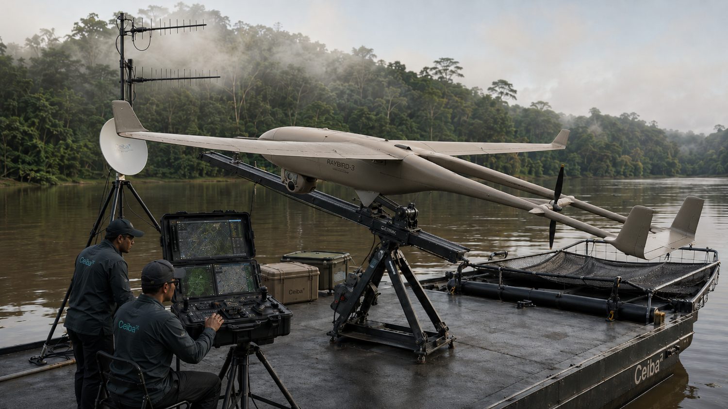
Drones — long-range LiDAR survey
The platform is the Skyeton Raybird fixed-wing aircraft carrying a survey-grade LiDAR. One aircraft covers in a single flight what a quadcopter never could, which is what makes basin-scale scanning economic. A partnership with Skyeton is in place; the first Amazon pilot flight is scheduled.
Spec — Drone. Endurance up to ~28 hours · cruise 80–160 km/h · ceiling 3,500–5,000 m · control range up to ~150 km · payload up to 5 kg · carries full-waveform RIEGL LiDAR, a high-resolution camera, a thermal sensor and X-band radar (SAR) · up to ~840,000 hectares scanned per flight.
Our own sensor nodes
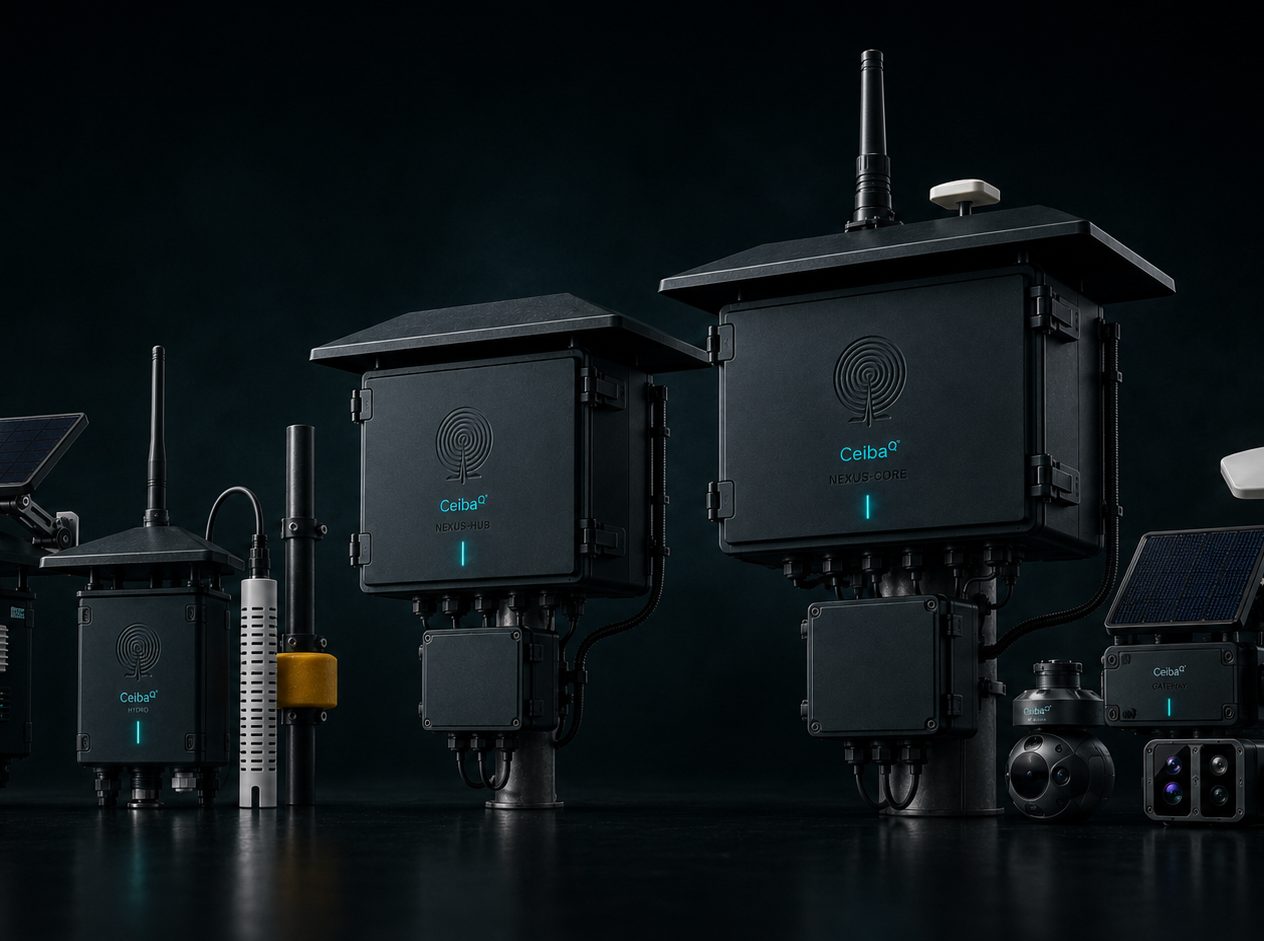
We take proven sensors and build them into purpose-designed nodes, in tiers, so cost scales with the job. The calibration-reference node carries the full measurement suite; the cheap leaf nodes blanket the forest.
Spec — Nodes.
- ECHO — ~30–50 parameters: bioacoustics, microclimate, soil, threat alerts
- NEXUS-Hub — ~300–500 parameters: cameras, acoustics, growth, CO₂, rainfall
- NEXUS-Core — ~1,500 parameters: the calibration-reference node (flux-grade, soil profiles, structure, hydrology)
- HYDRO — ~10–20 parameters: water level, inundation, flood pulse
A flux supertower — direct carbon measurement
A research-grade, SMEAR-class eddy-covariance flux tower, developed with the University of Helsinki. It does what satellites and formulas cannot: it measures the carbon, methane and water the forest actually exchanges with the air, instead of estimating it. That direct measurement is the truth the rest of the model is calibrated to, and it is a layer competitors who read the forest from above cannot reproduce.
Spec — Flux tower. Eddy-covariance CO₂ / CH₄ / H₂O flux · greenhouse-gas profiles (N₂O, NH₃) · micrometeorology and energy balance · soil respiration · biophysics (phenocams, sap-flow, dendrometers). Built to the SMEAR standard with an aerosol subset. Replaces modelled carbon with directly measured flux.
Connectivity, teams and science
- Connectivity in the forest. Nodes talk to their hub over long-range, low-power radio (LoRa); the hub backhauls over Starlink, so the network streams from deep forest with no fixed infrastructure.
- Field Verification Teams. Trained teams install the network, sample, and verify conditions on site. They are both a cost and part of the moat.
- Data and science partnerships. The historical state data and the underlying science are anchored by partnerships with UNAP (Universidad Nacional de la Amazonía Peruana) and IIAP (Instituto de Investigaciones de la Amazonía Peruana), the Peruvian Amazon's national university and research institute.
What turns it into one model
- Proprietary AI protocols process and fuse every signal, calibrate the field measurements across the whole forest, and attach a quantified uncertainty to each value.
- ROOT carries its own reference libraries (an environmental-DNA library, plus acoustic, spectral and allometric signatures) and its own AI models — both built once and reused at near-zero marginal cost, which is why gross margin reaches about 86% on repeat data sales.
- Before release, every value passes the model's quality checks and is cryptographically signed with its full provenance, so the customer can trace it from the field measurement to the claim.
Build status — honest read
ROOT is the company's core asset, and it is being built. This round funds a lean proof of concept on a single ecosystem subtype on the concession we control, enough to prove the model and reach the first contract; the full model, the flux supertower, the wider node network and the environmental-DNA library follow at the seed stage. Where this data room gives parameters, coverage or accuracy, those are design targets, not delivered results.